Glas Bheinn – Eas a’ Chùal Aluinn (15.2 km, 1149 m)
Beinn Leòid (15.1 km, 787 m)
Coire a’ Mhadaidh – Inchnadamph (7.9 km, 332 m)
Day 1, Thursday 10 October 2013
Inchnadamph – Glas Bheinn – Eas a’ Chùal Aluinn – Loch nan Caorach
15.2 km/1149 m/08:30 hrs
Corbett: Glas Bheinn (No. 66)
My original inspiration for this trip had been the Sutherland Trail, but on closer inspection of the route I had found that it didn’t include any hills (unless I’d make the detour over Suilven), and so I decided to make the route more interesting by adding a few Corbetts and Grahams to it. It also turned out quite awkward to get to the start, and back home from the end point by public transport, and after some more tweaking, my route had no resemblance whatsoever with the Sutherland Trail anymore…
Unfortunately I had used up all my holidays for 2013, and instead of doing a six day backpacking trip, I had to split the walk into two halves that I could do on my days off, starting with this round trip from Inchnadamph. In April 2014 I did the second half, another three day trip from Achfary, which was a good training for the TGO Challenge.
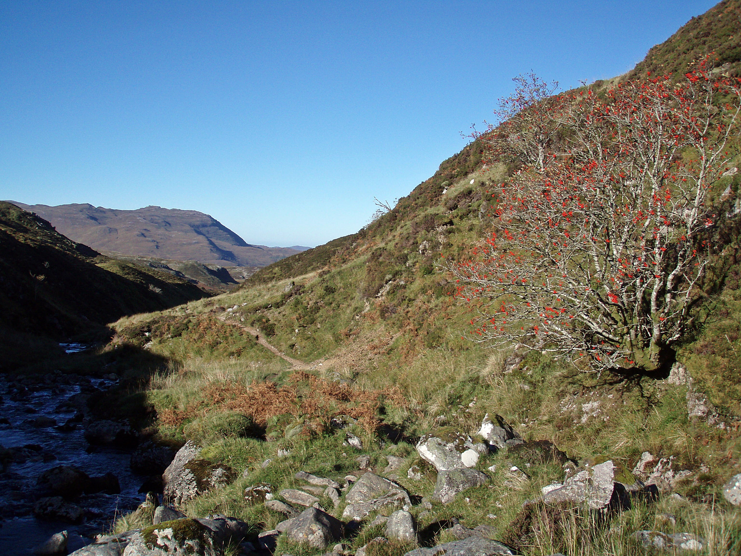
It was warm and almost windless when I started at 10:00 from the walker’s car park by the Inchnadamph Hotel. First I followed the track into Gleann Dubh for a few hundred metres, then turned left where a smaller path leads along the Allt Poll an Droighinn.
View back to Inchnadamph.

Waterfall at Meall nan Caorach.

I had a short break in this little open shelter by the path.

The bridge at the outflow of Loch Fleodach Coire has collapsed, and with the stepping stones partly under water, I got slightly wet feet. But the ground after the crossing was very boggy anyway, so it didn’t really matter.

Loch Fleodach Coire.

Lochan Bealach na h-Uidhe.

Approaching Bealach na h-Uidhe.

At the bealach, I left my rucksack and climbed up Glas Bheinn’s E ridge.
Lochan a’ Choire Ghuirm.

The walk in, with Loch Fleodach Coire and Lochan Bealach na h-Uidhe in the foreground, and Ben More Assynt and Conival on the skyline.

Stone shelter at the S end of Glas Bheinn’s summit plateau.

Suilven.

Loch Assynt.

Ben More Assynt and Conival.

Glas Bheinn summit cairn.

Handy seat embedded in the summit shelter.

The scenery in all directions was lovely, but I found the view NW to Quinag most impressive.

Arkle and Foinaven.

My next target, the Stack of Glencoul.

Inchnadamph.

Beinn Uidhe.

View across Coire Gorm.

Back at the bealach, I picked up my rucksack and continued along the path into the wide coire E of Glas Bheinn.

Eas an t-Srutha Ghil.

At a small lochan, the path splits – the left hand branch leads to the top of the Eas a’ Chùal Aluinn waterfall, but I kept to the right. Where this path ends, I followed a stream down to the Abhainn an Loch’ Bhig. The terrain is a bit rough down in the glen, and lots of minor contributary streams and eroded parts of the river bank forced me to make detours.

But I soon got the reward for my efforts – the first view of the Eas a’ Chùal Aluinn, Britain’s highest waterfall with a sheer drop of 200 metres.

I forded the Abhainn an Loch’ Bhig and ascended the slopes N of the Eas an t-Srutha Ghil. It was slow going around crags and over steep and slippery terrain, and took me much longer than I had expected.

The upper glen of the Abhainn an Loch’ Bhig.

Higher up, the views of the waterfall got even better, but it was difficult to take photos as the sun was now almost right behind it.

Loch Beag and Loch Glencoul.

Daylight was beginning to fade when I reached the N end of Loch nan Caorach at 18:30, and I wandered around for quite a while, struggling to find a place to camp on the lumpy and boggy terrain. But eventually I found a suitable pitch and settled down for the night.

Loch nan Caorach – Stack of Glencoul – Beinn Leòid – Coire a’ Mhadaidh
15.1 km/787 m/09:30 hrs
Corbett: Beinn Leòid (No. 67)
It was a quiet night and I had a good sleep, but I woke up a few times and was surprised about how warm it felt, there was no sign of the frost that had been forecast for the night.

I left my camp site at 08:30 and climbed up to the ridge above Loch nan Caorach.

Leaving my rucksack on the ridge, I made a quick detour to the Stack of Glencoul. I had first noticed this interesting little hill a few years ago on the walk-in to Glendhu bothy, and ever since I had been waiting for an opportunity to climb to its top.
Loch Glencoul from the summit of the Stack of Glencoul.

Glas Bheinn.

After enjoying the views from this great viewpoint, I collected my rucksack and descended into Glen Coul. At first the terrain consists of a mixture of crags and boggy ground with peat hags, but further down it turns grassy and becomes much easier to walk on.
View up the glen towards Loch an Eircill.

Glencoul River.

After fording the Glencoul River, my original route plan was to stay on the track in the glen until it peters out at the end of Loch an Eircill, and then ascend the southern slopes of Beinn Leòid. But from above I had seen a track (not marked on the map) that seemed to provide an easier access up the SW flank, and I decided to use that instead.
Looking back to the Stack of Glencoul, with Quinag in the background.

On the Bealach Beinn Leòid, looking towards the summit.

The Graham Meallan a’ Chuail which would have been my next target, but I had already resigned to the fact that I would have to come back another time for the Grahams and Corbetts further E and NE from here.

View towards Kylesku and Eddrachillis Bay.

Ben Stack, Arkle and Foinaven.

Beinn Leòid summit trig point.

Quinag.

Large cairn on the descent to Drochaid Beinn Leòid.

Loch Dubh and Meallan a’ Chuail.

South of Drochaid Beinn Leòid, the terrain becomes very difficult again. Heading towards Gorm Loch Mòr across a huge expanse of wet ground and peat hags, my progress was extremely slow.

With some of the peat hags being too high to jump down or climb up, I had to make many detours around them.

I tried to follow the Fionn Allt, and crossed it several times.

I arrived at Gorm Loch Mòr shortly before 16:00. The current at the outflow of the loch was strong, and I couldn’t see how deep the water was. I waded through it very slowly because of the slippery rocks at the bottom, but thankfully the water was only knee-deep and I made it across safely.

Across Fionn Loch Mòr towards Glenn Cassley.

I made my way towards Coire a’ Mhadaidh, looking for a place to camp. The wind had picked up in the meantime, and I needed a sheltered pitch. Eventually I found a patch of flat, dry ground beside a small stream and in a little dip.
I didn’t sleep very well that night. The wind had turned into a storm and with the fabric flapping in the wind, my tent was making a lot of noise. It also sounded as if a roaring stag was standing right beside my tent – a rather worrying thought!
Day 3, Saturday 12 October 2013
Coire a’ Mhadaidh – Gleann Dubh – Inchnadamph
7.9 km/332 m/04:15 hrs
My camp site below Coire a’ Mhadaidh.

Approaching An Tuadhan, I was trying to figure out the best ascent route to the lochan in the upper coire. The direct route on the right-hand side of the waterfall looked steep, but doable, and so I headed up that way (left-hand side of the photo).

Waterfall below Coire a’ Mhadaidh.

Looking back to the terrain I had crossed the previous day, with Beinn Leòid and Meallan a’ Chuail in the distance.

Lochan in Coire a’ Mhadhaid.

To get to the bealach between Conival and Beinn an Fhurain I had to cross a steep scree slope. A slip on this would have probably ended with a tumble into the loch, so I took my time and moved across very carefully.

The bealach – I was looking forward to getting out of the shadow and into the warm sun.

I was being watched closely…

Nearly there!

A stubborn cloud covering the summit of Conival.

View SW, with Cùl Mòr in the centre and Canisp on the right.

From the bealach I followed the standard route down into Gleann Dubh. At a rock band high up in the coire, there are two well-used ways down, each of them marked with a cairn at the top. They are both straightforward, so this time I just used the one I was closer to, which was the more southerly one.

Allt a’ Choinne’ Mhill.

I had not met anyone else for the last two days, but suddenly I encountered a lot of hillwalkers and -runners on their way up from Gleann Dubh, and stopped to chat to a few of them.
Higher up, a cold wind had been blowing, but down in the glen it felt nice and warm in the sun.
View back to Conival.

The pleasant walk along Gleann Dubh, with Quinag on the right dominating the view.

Unfortunately, coming closer, this monstrosity dominates the view… makes me wonder how anyone could get planning permission for that (it wasn’t there the last time I visited the area)?!

“Stone Art” near the confluence of the Allt Poll an Droighinn and the River Traligill.

This turned out to be my last backpacking trip in 2013, and apart from the stormy second night I had been very lucky with the weather. In April 2014 I returned to Sutherland to walk the second half of this route and to climb some more Corbetts and Grahams around Loch More, again in great weather.


Looked like a great trip in a magnificent piece of country.
Thanks for sharing.
Many thanks!
Yes it was great to revisit an area that I seem to have neglected a bit for the last few years…
Some tough walking around here but plenty of rewards to be had.
Looks like you had a fine few days, not so many people get to view Eas a’ Chùal Aluinn from below but definitely worth the effort.
It certainly was worth the effort, it is a beautiful area not overcrowded by walkers (although I think the Cape Wrath Trail passes that way as well).
Looks a bit too tough for me all that! But great training for this year’s TGO challenge 🙂
Always wondered what it would be like to be in that countryside behind Conival and Ben More Assynt so great to see your, again, superb photos.
Carol.
Many thanks, yes it was tough because the route was mainly pathless, but that only added to the remote feeling of this area!